I assembled a photo slideshow of photos I took while on my road trip in the Pacific Northwest in May and June of this year. The video is about 5 minutes long and the musical soundtrack is the Cat Stevens song, “On the Road to Find Out.”
For the best enjoyment, click on the “Watch on YouTube” link below and choose to watch it in full frame mode.
Wednesday (June 29): Yesterday morning, I said good bye to Fran and Jerry, the A-frame rally organizers along with a few other attendees and hit the road about 10:30AM. It was already heating up and the weather forecasts were announcing “excessive heat warnings” for the day.
Highway 395 is a major north/south thoroughfare on the eastern side of California. The part I drove on was a two-lane highway with occasional passing lanes. Broken yellow lines were also available for drivers who didn’t want to follow a car pulling a trailer driving the speed limit. I was driving 55 mph (towing speed limit) in a 65 mph zone. I inched my cruise control up to 60 out of empathy for the cars behind me. My bigger empathorial moments occurred whenever I would pull off to the side of the road and let everyone else fly by.
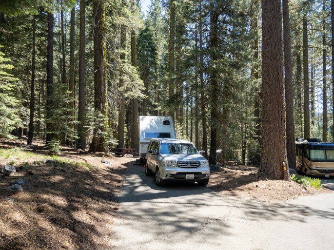
I turned onto the forest service road that leads into the Jackson Meadows area (East Meadows Campground). It was a familiar drive – this is the campground that Laura and I camped at with bikes, kayaks, and our dogs. It was an annual tradition for a number of years, often times with my brother and sister-in-law and their friends. Lots of fun memories.
In 2013, my friend Robin and I also camped here. The camping trip was supposed to include our mutual friend, Dick. Sadly, Dick passed away a month prior to our scheduled trip. Dick’s memorial service was held on the first day of the camping trip. After the conclusion of Dick’s memorial, Robin and I drove up here to Jackson Meadows. During our campout, he and I fashioned a floating memorial from driftwood and flowers, we each wrote a special message on it and set it afloat from our kayaks on the waters of the reservoir. So, some sad memories, too.
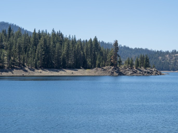
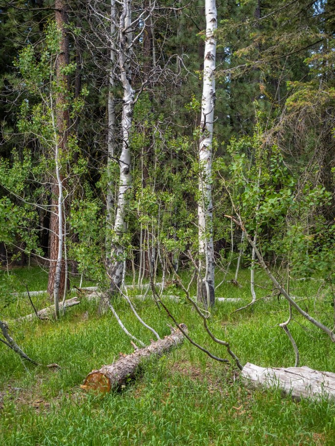
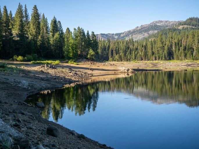
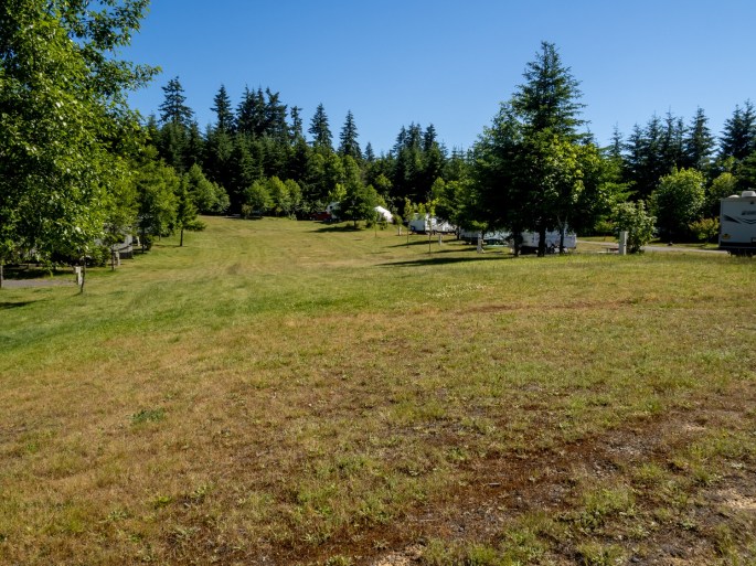
East Meadows Campground, Jackson Meadows Reservoir
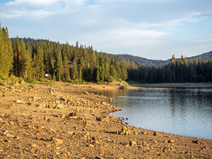
Being here today has been a surprising experience. I originally booked a reservation here to break up the long drive home from Eagle Lake. I was familiar with the campground so it seemed like a logical choice. And it was. But the surprise came with the various emotions I experienced after arriving. It was a bit like coming back to a hometown. I walked the loops of campsites and remembered some of the events of earlier visits I described above. I took a swim in the lake and thought about the numerous swimming and kayaking adventures. And the fun campfires trickled into my memory stream as well. I noticed I was feeling a bit melancholy. Not sure if it was related to the memories or the awareness of the approaching last drive. Maybe both.
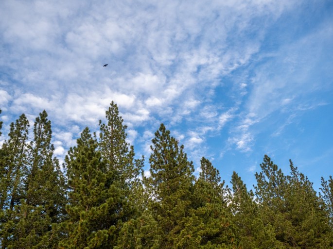
Jackson Meadows ReservoirJackson Meadows ReservoirSomedays I feel like this tree looks.The campground is located in a beautiful setting.Flying high.Evening light
As dusk approached, I walked down to the waterline and watched the sunset on my last day of this trip. In familiar fashion, it was a beautiful experience.
Last sunset of this trip
So, in a couple of ways, this location brings me full circle, to a place of closure: it is the last stop of my five-week roadtrip journey. It is a return to a place from a different time in my life.
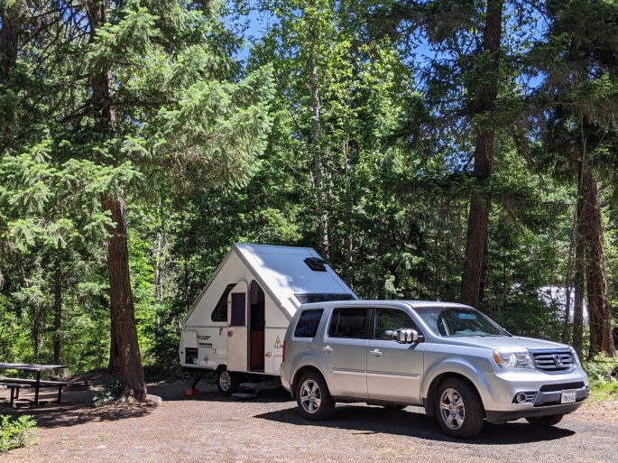
And in a funny coincidence, it is a return to the campground where I was first introduced to an A-frame camper. My brother’s good friend Bob (and I claim Bob as my friend, too) arrived at one of those annual camping trips with a new A-frame trailer. As he showed us the various features and logistics of setting it up, I mentally made a note to be sure I got one of those someday. So here I am.
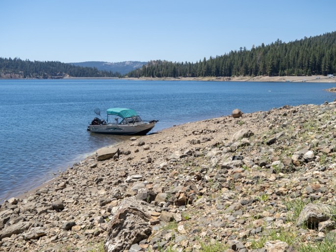
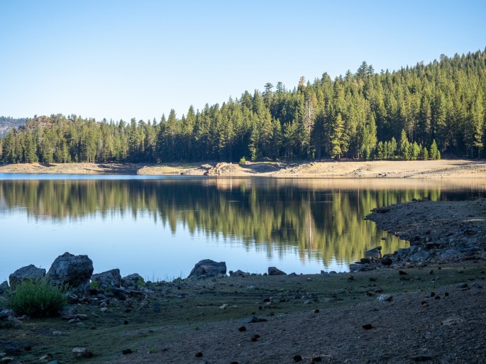
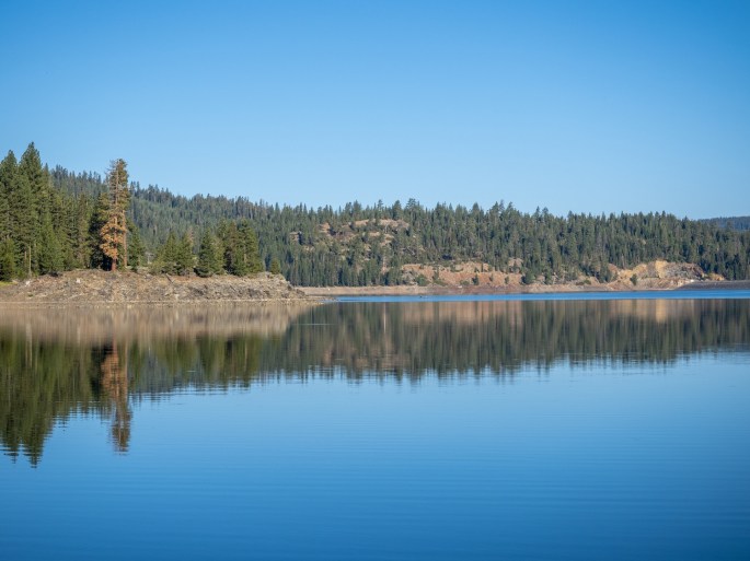
This morning, I walked down to the water for an early visit. The water was calm, almost mirror-like. It was early enough that I was pretty much alone at the lake. The air was still. My hearing is bad so I couldn’t hear how quiet it was. I could see one small fishing boat across the lake, trolling along peacefully.
Early morning at the lake. All is calm.The air and water were still.
Soon, I’ll drive down into the muggy valley, park the trailer and unpack. It will likely be 100+ degrees. And I know I’ll be sad about the end of this trip. I’m scheduled to be camping again in less than three weeks…if I can wait that long!
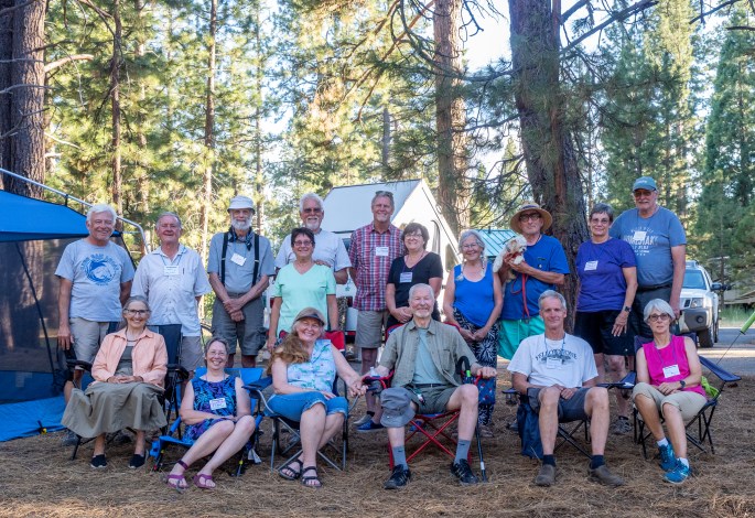
Sunday (June 27): The A-frame rally has been a lot of fun. The rally is hosted by volunteers who are centralized in the Pacific NorthWest. The rallys are normally in Oregon and Washington, but this one was planned at Eagle Lake in the Lassen National Forest because of availability during Covid.
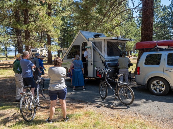
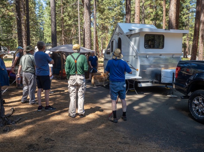
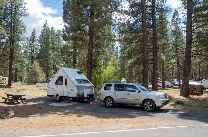
It was fun to see several A-frames in the campground.
Thirteen A-frame trailers with about 24 people attended this rally. It was my first time meeting up with this group. The participants were friendly and very comfortable to hang out with. A variety of expertise levels made this a great opportunity to get help with problem-solving.
The rally was very well planned, communicated and it went well without any issues. The primary purposes of the rally are to meet and greet, show and tell, and care and maintenance. Each morning begins with a coffee assembly at the home base campsite, an activity, such as the touring of A-frames, and the evening finds us gathering for wine and conversation.
Show and Tell – touring the A framesShow and Tell – touring the A frames
I enjoyed the A-frame tours; they were a great way to see how others have improved their trailers. I picked up some good ideas for future projects.
Each evening we met to share info, ask questions and socialize
On one morning, several of us rode our bikes on a paved trail that connected our campground with a couple of others, as well as the marina. The marina was a great place to take a break, eat some ice cream in the shade and rest up for the hot ride back.
Great bike ride on the trails along Eagle Lake
Most everyone left on Sunday morning; the few of us remaining drove in to Susanville and had lunch and beer tasting at the Lassen AleWorks brewery. The air-conditioned room was a great choice, as the temperatures reached the high-90s the last two days.
Plenty of excellent beer options on this hot day.
I enjoyed my time at the rally and enjoyed meeting the people. I plan to check out next year’s rally – I’m hoping it can be another chance to include the rally as part of larger, longer road trip. There are still plenty of places in the Pacific NorthWest that I want to explore.
Group photo, taken on the last evening of the rally.Camping under the stars.
Tomorrow I’ll travel about 3 hours, heading in the general direction of home. I’ll spend one night at a favorite campground at Jackson Meadows Reservoir and make my home on Tuesday.
Friday (June 25): Yesterday was the second travel day to get to Eagle Lake. I left Tulelake about 10:00 AM after a rough night. One of the car alarms in the RV parking area kept going off, repeating until about 11:00PM. Around 12:45AM, I realized I was awake and noticed flashing red lights penetrating the little openings in my trailer curtains. I saw two ambulance/EMT trucks parked directly in front of my site. The EMTs were walking in and out of the fifth wheel trailer parked next to me. After about 30 minutes, they all left. Around 4:00AM, same deal – flashing red lights, two emergency vehicles and probably the same responders. In the better light, I noticed that all the emergency personnel were casually dressed (blue jeans, sweatshirts, ball caps) and surmised that they were all volunteer responders. This time they gurneyed an older man out to the ambulance and left. I went back to sleep with some assurance that he was being taken care of.
On the road again, driving through upper Northern CaliforniaRemnants of 2020 wildfires
The drive was warm and many travelers were on the road. The drive took about 3 hoursto reach Merrill Campground at Eagle Lake. The campground is well laid out, the sites are spacious with plenty of space between them. Restrooms are convenient, but the nearest shower facilities are a couple miles away at the marina.
Campsite 141 at Merrill Campground, Eagle Lake Recreation Area, Lassen National ForestMerrill Campground is a very nice campground. Most sites have electrical and water, a few have full hookups.Eagle Lake, as viewed from the Merrill Campground
The campground has a nice beach at the lake, but the low water level puts the beach about 150 yards from its normal reach.
Finally unpacked the bike and took it for a rideLooking back at Merrill Campground from the beach
I rode my bike around the campground, checking out the various loops. It was fun to see a good representation of A-Frame trailers around the campground. I would guess about 12-15 trailers. I’m looking forward to meeting up with the attendees of the rally.
The evening closed out with a thunderstorm, naturally. It was more wind than rain and lasted about an hour. I realized I was tired, after a low-sleep night and a few hours driving in the heat, I was ready for some sleep.
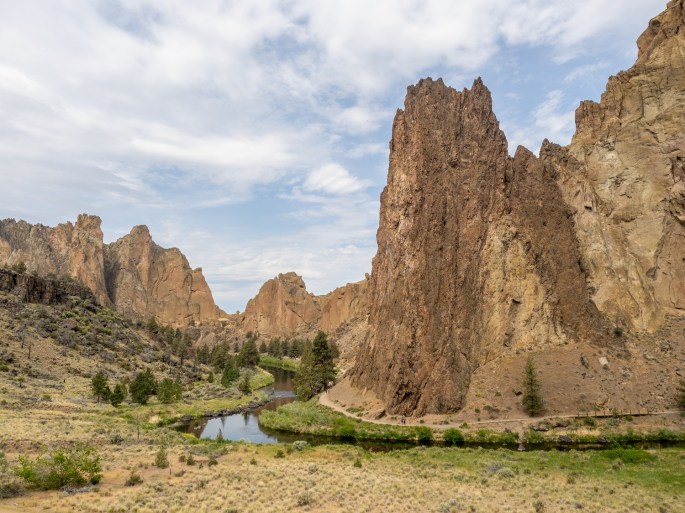
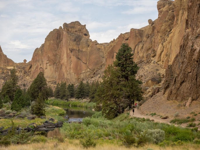
Tuesday (June 22): The Smith Rock State Park is located about 20 miles from Prineville. The park reopened less than a month ago after being closed for more than a year due to Covid.
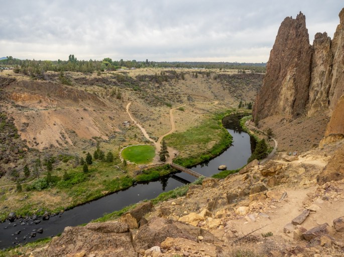
The Crooked River winds through the park
I spent a couple hours at Smith Rock hiking the trails this morning. After last night’s thunderstorm and balmy night, it felt good to walk in the cooler air. Not only was the air cool, it was absolutely still. Occasionally, I would stop hiking to take a photo and notice the silence. It was so quiet that I felt conspicuous when I restarted hiking because my shoes were making noise.
This area has stunning rock spires that stretch vertically from the canyon floor. The Crooked River wiggles through the spaces between the rock faces. In the 80’s this park was a huge draw for rock climbers. Now, in addition to the continued focus on rock climbing, miles of trails beckon hikers and bikers to explore the area. I hiked trails in both directions along the river’s path.
Rock climbing class
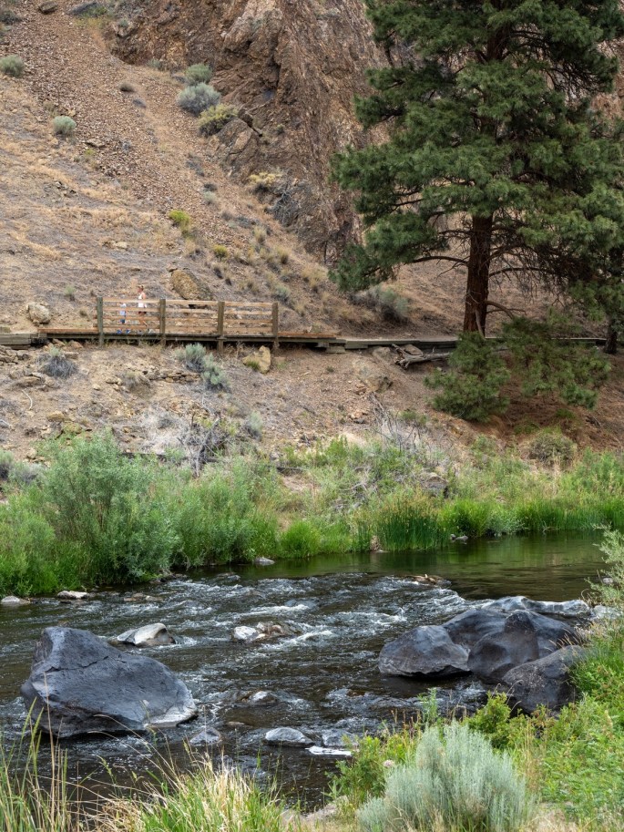
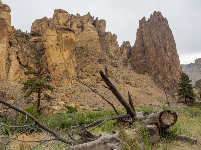
After returning to my starting point, I got the notion to take the Misery Ridge Trail. Somebody had a sense of humor when they named this trail. It immediately transitions into switchbacks as the hiker climbs from the trailhead at the bridge.
The Misery Ridge Trail The Misery Ridge Trail. I hiked up as far the upper right area where the trail wraps around the rockLooking down from the upper part of the Misery Ridge Trail
I climbed about half the vertical height of this trail before stopping. I was rather proud of myself for not being intimidated by the sheer height of the trail, as well as its close proximity to the steep edge. When I began to hike back down, all that changed. When hiking down it was hard to not see the height and precariousness of the trail.
Don’t miss this right turn!
By the time I reached the bottom I was pretty tired. I still needed to cross the bridge and climb out of the canyon one more time. Slow and steady was my mantra (when I could breathe). The cool air had warmed up by late morning, and the humidity seemed to have increased, too.
I drove into nearby Redmond and met up with a former co-worker/current friend for lunch. Jerry and I share a strong interest in photography and we often send emails back and forth discussing the latest photo gear and techniques. He had recommended I visit Smith Rock SP and gave me good advice to get there early before it got too busy.
We had a terrific lunch of tacos from a food truck parked at a taphouse. It was fun to catch up with him and he had more suggestions of places to check out in the area.
I spent the remainder of the afternoon buying groceries and supplies for the last week (sniff, sniff) of my trip. When I was leaving Safeway in Redmond, the lightning and thunder had started. I drove back to Prineville and outran the storm by a couple hours. When the storm did arrive, it was not nearly as powerful as the previous night’s fracas. In addition to another stunning sunset, I was treated to a full rainbow at the RV park. One end of the rainbow burrowed into the roof of my trailer. I think I should name my trailer “Pot of Gold.”
A rainbow send-off
Tomorrow is the first of another two-day travel leg. When I stop for the night tomorrow, I’ll be back in California.
Monday (June 21): Normally, Travel Days are not very eventful. They are more of a utility day, a necessary chunk of time spent moving from one area to another. However, this Travel Day was a little more interesting than others.
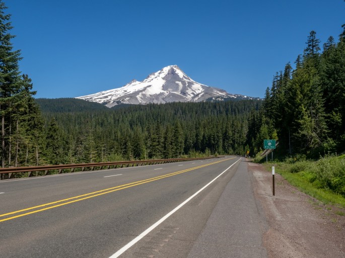
I left the campground near The Hood River around 11:00AM and headed south on the nearby highway. My route for the day would be on two-lane highways exclusively. I had received a photo tip from a friend from my home neighborhood about a great spot to see Mt Hood with a lake (Trillium Lake) in the foreground. When I looked up that location, I realized my travel route would pass very close to it. Perfect!
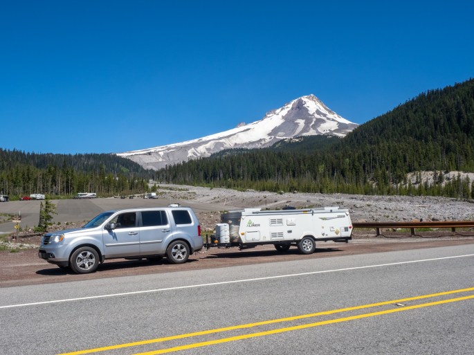
On the way out of the area, a few extra views of Mt. HoodA view of Mt. Hood from the east. It looks like some boondockers in the snow park parking lot.
The road out of the area passed closely to Mt. Hood. I noticed how the shape changed as I viewed it from the east, then later from the south.
I reached Trillium Lake and drove into the day use area. The ranger at the gate cautioned me that the parking lot was jammed full and I would not be able to park in the lot. He did say I could try to park in some gravel areas along the main road if they were open. I thanked him as I handed him my $10 entrance fee and drove in.
The ranger was not joking, the parking lot, the roads and the trails were packed with people. I saw an open area in the gravel that was big enough for my car + trailer, IF I could back it in. As in, parallel park with a trailer. I was determined and it was not very difficult to do. As I walked away from the car, I glanced back and laughed. I had no idea how I was going to turn around when I left.
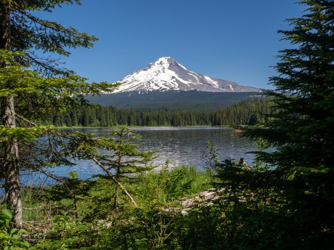
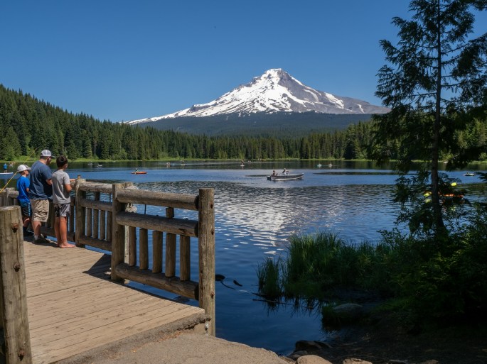
Parallel park with a trailer? Heck, yeah!Mt Hood viewed from Trillium lakeMt Hood viewed from Trillium lake
The walk to the edge of the lake was less than a quarter mile and made everything worthwhile. The deep blue water with the snow-covered Mt. Hood rising above was a great way to say Good Bye to this majestic peak. I gathered some images with my camera and found my way back to the car.
I had noticed that the road ahead would cross over a small dam; I was not interested in trying that route. About 50 yards behind my parking job was an intersection. I pulled out of my space, then backed up the 50 yards and back-turned into the intersection. Spun the wheel around and headed for the open road.
The rest of the drive went smoothly. Highway 26 was very busy and I took several opportunities to pull off to the side of the road and let the train of cars behind me pass. It’s a bit strange, I notice the drivers in Oregon don’t speed very much. Whenever I reach a passing lane, I move directly to the right lane so the cars behind can take advantage of the extra lane. Yet, when I look back, most of them are also behind me in the right lane. If someone does pass me, they are moving only slightly faster than I’m going. When I think of passing lanes in California, I think of Mad Max.
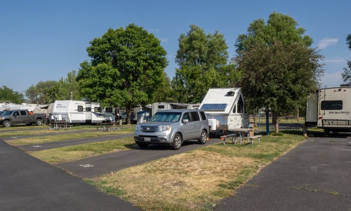
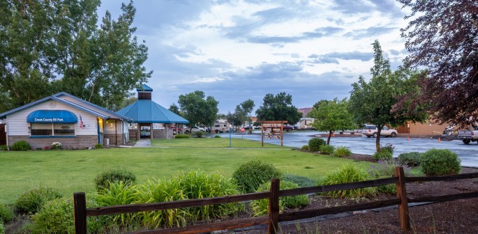
I reached the Crook County RV Park in Prineville in the mid afternoon. It’s a clean large RV park with plenty of full-hookup spaces. The restrooms and showers (no tokens) are modern and a nice laundry facility is on the premises, too. I noticed the heat when I arrived, it was 93 degrees. This might be the warmest day I’ve experienced since I left Lincoln 28 days ago. After setting up the trailer, I took a well-deserved shower and did two loads of laundry. For dinner I decided to try out a BBQ place I spotted as I drove through town earlier.
A nice calm and warm day at the Crook County RV Park.
The Crossroads BBQ Pit & Pub was open and lightly occupied. I had a very tasty dinner of a Philly Cheesesteak sandwich and the cook’s special beans. They were delicious. As I looked out the window at the intersection in front, I wondered if anything exciting ever happens in Prineville. I did see a county fairground, so that’s something.
About 15 minutes later, my question was answered. A powerful lightning storm had barged into town and it was putting on a show. The trees along the main street were swaying in multiple directions at once, and I wondered how my trailer was handling these strong winds. Then the rain started and several distinct bolts of lightning flashed across the sky, followed quickly by the companion thunder claps. I love thunderstorms – they remind me of the midwest and their intensity is humbling.
I drove back to the RV park as the storm was getting stronger, louder and brighter. Soon, it was directly overhead and the rain was pounding on the roof of my trailer. I looked up at the inside roof and watched the two panels shift about, heaving under the pressure of the wind. I was thankful that I had affixed the DIY rope/wind kit to my roof when I set up earlier, even though at that time it was sunny, warm and clear. All I could do now was trust that it would hold together.
And also take some photos. And video.
This was exciting, to say the least.
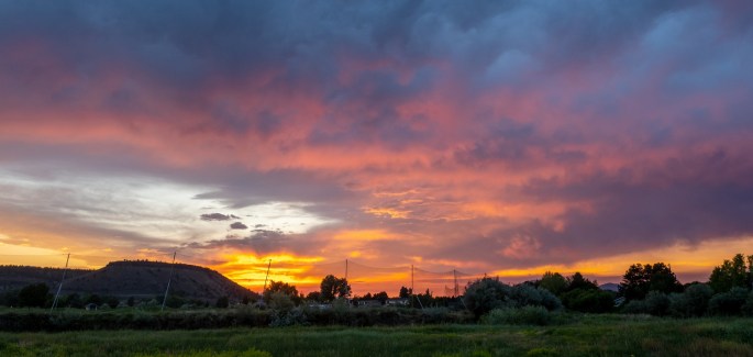
After about 20 minutes, the storm stopped. Like a Hollywood set, it just stopped. No wind. No rain (no winter’s cold…) Shortly, the colors in the sky reappeared and a beautiful sunset took center stage in the western sky.
Taken after the storm, the entrance to the Crook County RV Park. The county fairgrounds are down the street.The end of an interesting Travel Day.
I was thankful for the beauty of the sunset as it seemed to gently guide the day to a close.
Sunday (June 20): Happy Father’s Day! This was a rare time that I wasn’t available to see my sons on Father’s Day. We had good phone chats instead.
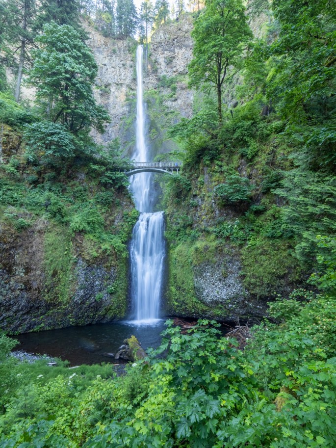
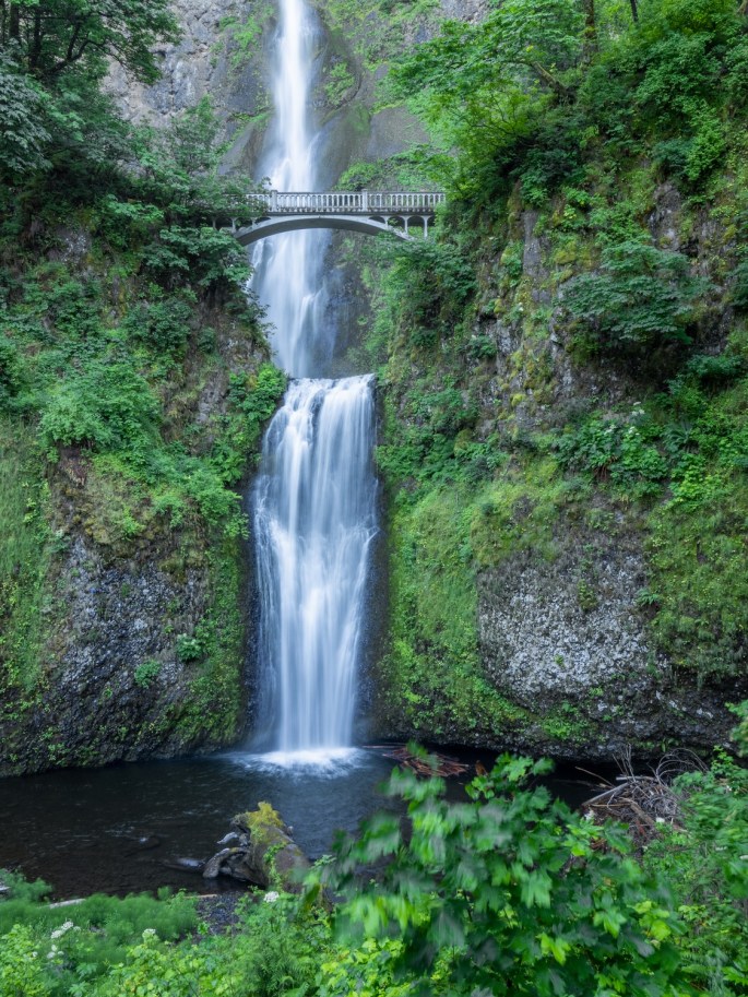
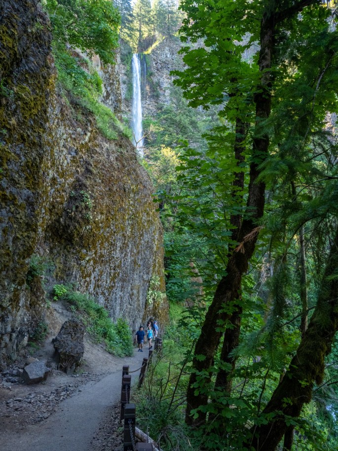
I did manage to wake up with the alarm and hit the road early to visit Multnomah Falls. It’s about a 45 minute drive and I remembered seeing a sign on the highway about the parking lot exits being closed after 9:00 AM on the weekends. I arrived at the parking lot just before 8:00, so I made good time. Other people were milling about, but it wasn’t crowded.
In the early morning (8:00 am) the entire falls are in the shade.
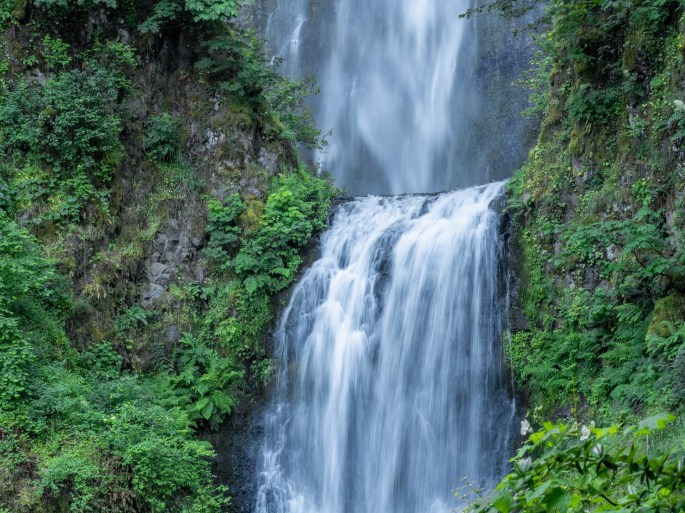
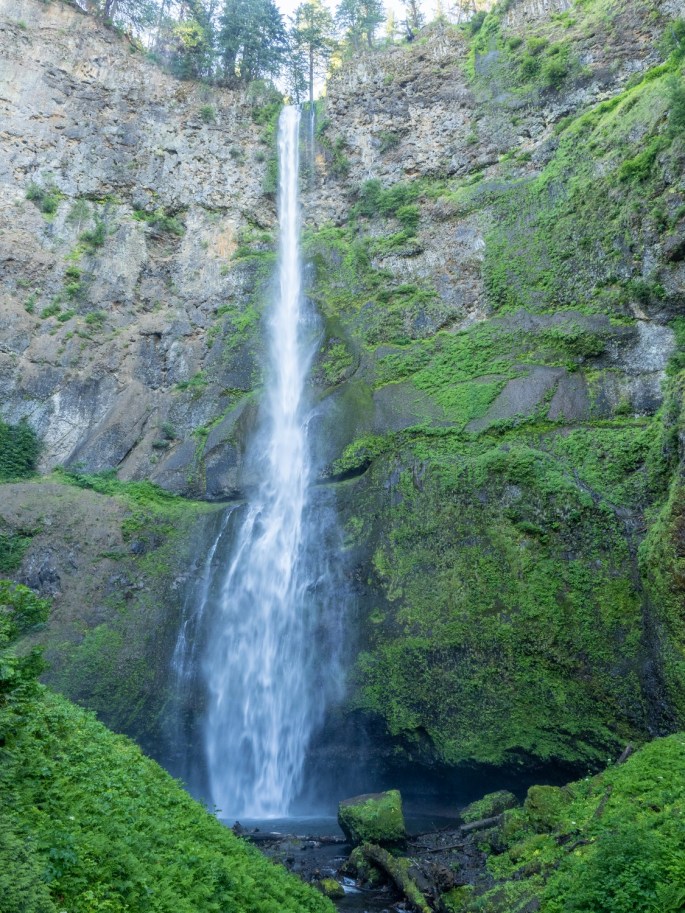
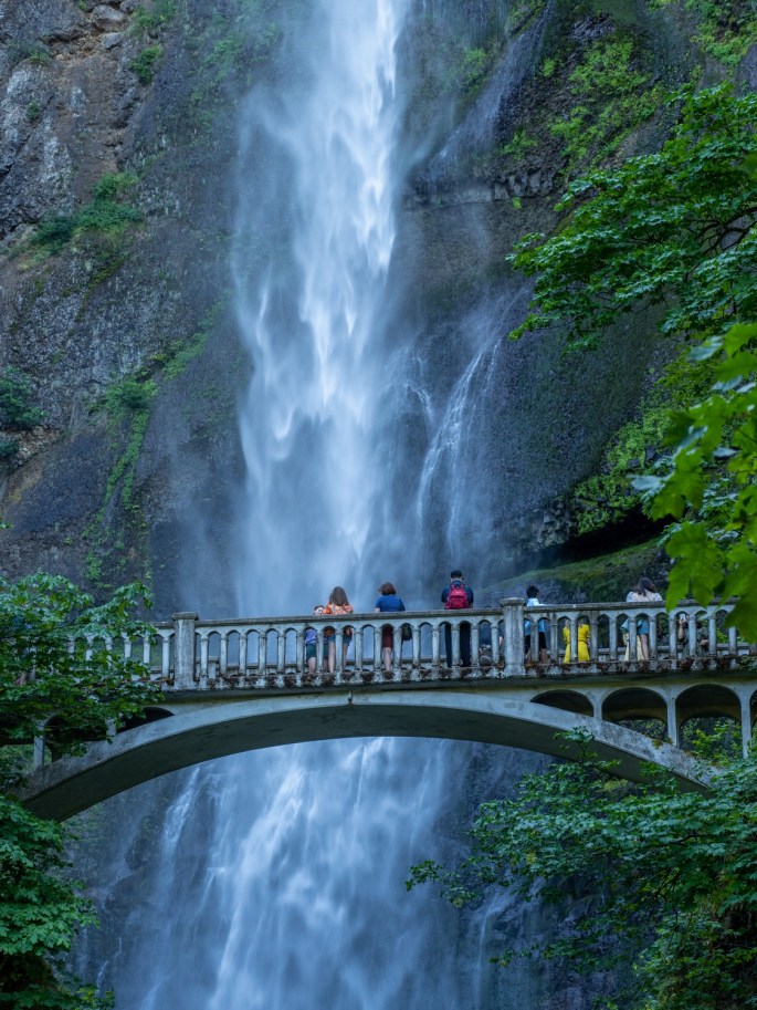
Multnomah Falls are located very close to the highway. The parking lot is opposite the railroad tracks and an under-the-tracks tunnel connects to the waterfall area. The lower viewing platform gives a stunning view of the long ribbon of water as it falls more than 500 feet, and continues another 60+ feet to a collection pool at the bottom. It is pretty dramatic and the photos do not do it justice.
The lower falls and Benson Bridge.Lower falls detail
It was fun to people-watch on the lower platform. Lots of selfie sticks (and selfie arms). I would frequently offer to take photos of a couple or a family so they could all be in the picture together.
The lower viewing platform offers an excellent introduction to Multnomah Falls
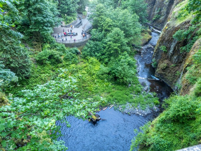
The hike up to the observation bridge, known as Benson Bridge, is a short climb with a few switchbacks. This location offers a great view of the landing area of the upper falls. I was enamored with the soft spray of falling water juxtaposed with the large moss-covered boulders and rock walls.
Looking down from Benson Bridge at the viewing platform.The upper fallsUpper falls detailUpper falls detail
A trail continues up to the top of the upper falls, but I chose to spend my time near the landing areas. I took 252 photos of the falls. Many of them were multiple clicks of the same image, with the randomness of the falling water patterns making the difference.
This trail leads to the top of the upper falls. Upper falls detailBenson BridgeColumbia River Gorge, looking eastColumbia River Gorge, looking west
By about 10:00 AM I was ready to leave. The crowds had arrived and the sunlight was beginning to infiltrate the softly lit area of the falls.
I’m very happy I made the drive to visit Multnomah Falls. This is a location I’ve been wanting to see for many years.
Tomorrow is a travel day as I move south into Central Oregon. I’ll be staying at Prineville, Oregon which is in the Redmond and Bend area.
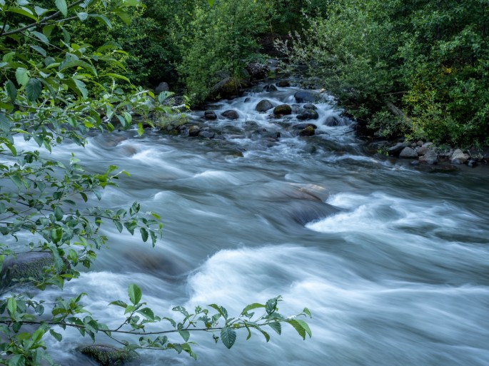
Saturday (June 19): I trekked out late yesterday evening and walked along The Hood River as it flows alongside this campground. I waited until dusk for better light for photos. The mosquitos were abundant, but they were not interested in my blood. I’m lucky like that. Maybe I should sell my blood as a mosquito repellent.
The Hood River directly behind my campsite
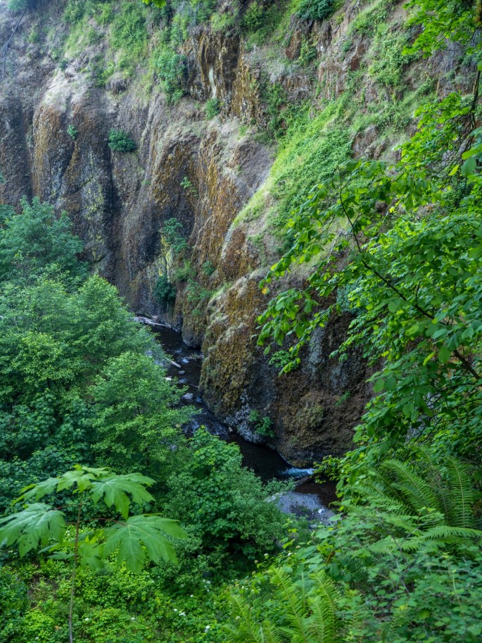
The river runs strong here and it has a powerful sound. I spent a little more than an hour trailblazing my way along the shoreline. I found a few sideline areas that probably have river flow when the water level is higher. All of these photos were taken within the boundaries of the campground.
The Hood River makes an impressive sound.Sometimes the water can be abstract.This is probably part of the river’s flow when the water levels are higherNext to my campsiteDirectly behind my trailer
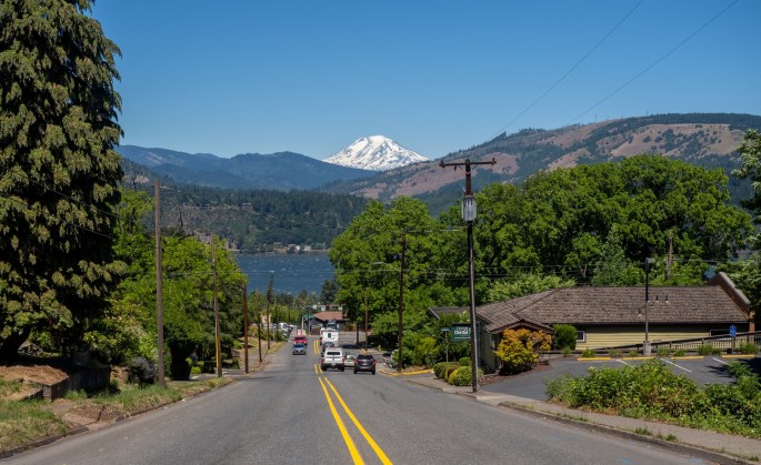
Today I ventured back down to Hood River. I ran a couple of errands and drove randomly in the upper hills of the city trying to find a good vantage point to get photos of the Columbia River Gorge area.
Downtown Hood River. It looks quiet because I waited for a line of cars to move along before I took the photo.I would call this the “Paint Sample House.” From the upper hills of Hood River, looking north at the Columbia River Gorge. Mt Adams is in the distance.The water recreation area of the Columbia River Gorge
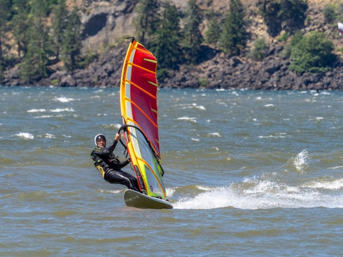
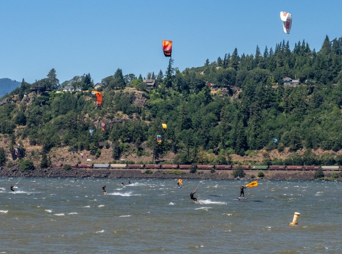
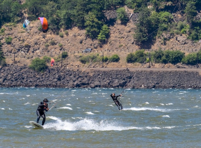
I drove down to the waterfront and directly parked in a free 3-hour parking space. Lucky again! A short walk brought me to the shoreline of the Columbia River. I was not alone. This area is a high adventure spot. The consistent strong winds and large water area combine for a great kiteboarding and windsurfing destination. And it was busy.
Spectators get to enjoy the wind, too!The launching/landing beach.
I would estimate the wind was blowing a steady 40 mph with gusts up to 50. Apparently, this is ideal weather for this sport, as the river area was a visual cacophony of movements of people, zig zagging across the water. There must be an etiquette to maneuvering in this crowd because there were no collisions and I never saw anyone’s kite ropes get tangled with another’s.
How do all these people not run into each other?
On a few occasions, a surfer would become separated from their board. Another surfer would skim along, grab the vacant board, make a quick turn and drop it off with its owner. It was fun to watch (and photograph) all the action. After a while I was able to predict when a surfer would be preparing to execute an airborne maneuver or make a sharp turn.
Mad skillsGetting some air!The guy looks like he realized he lost his hat.
All of this energy and chaos made me hungry. I drove back into town and got on the waiting list at the Full Sail Brewpub. After a 45-minute wait, I was seated at a window overlooking the Gorge. The amber ale was fresh and the burger was tasty.
The view from my lunch table.Mt. Hood, as I drive back to my campground.Mt Adams, to the north.
Tomorrow I plan to explore some of the outlying areas, including taking my chances at visiting Multnomah Falls. I will need to get up early in order to do that. Wish me luck.
Thursday (June 17): My road trip leaves the coast and turns inland. My next camping destination is the area around Hood River; I decided to break up the four-hour drive into two days. Since I didn’t have reservations for a camping location near Hood River, I figured it would be wise to arrive earlier in the day and improve my chances of getting a “first-come, first-served” space. It turned out to be a good strategy.
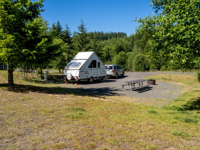
LL Stub Stewart SP has spacious campsites
My overnight stop was at LL Stub Stewart SP, about 30 miles west of Portland. I could tell I had moved inland, the temperatures were significantly warmer. Stub Stewart SP is a wooded area; the campground is pretty modern. About half of the spaces were occupied. The full-service campsites are spacious and spread out, each of the two loops has active camp hosts and the larger state park sports an abundance of hiking, biking and equestrian trails.
Inside the loop, lots of open space between the sitesPlenty of trails in this area
Friday (June 18): I woke up early and efficiently packed up to leave. My desired arrival time at Hood River was 11:00 AM and I had some errands to take care of along the way. In Beaverton, I got groceries, gassed up the car and stopped at an Amazon hub (thank you, Whole Foods) to pick up an item I had ordered a few days earlier. (Note to self: Amazon hubs are great for road trips)
My timing worked out well, I reached the city of Hood River a little before 11:00 and turned south to scour a couple of county campgrounds in the area. My first choice was Toll Bridge Park, about 16 miles south. Just to confuse things, the park is situated along The Hood River.
(“Hood River” = the city; “The Hood River” = the river, got it?)
Toll Bridge Park near Mt. HoodCamping!
I toured the prime camping loop and noticed a number of other vehicles doing the same thing. I spotted a nice campsite with partial shade, water and electric hookup, and occupied it. By noon, I was camping – Jackpot!
After changing into inland-warm-weather clothes, I drove back to Hood River to check out the town. Traffic was snarly, the parking was scarce and lots of people were enjoying the warm Friday afternoon. This is definitely a prime destination for outdoorsy activities. For the record, most indoor businesses are still insisting on mask-wearing, even if vaccinated.
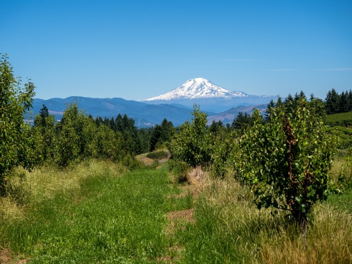
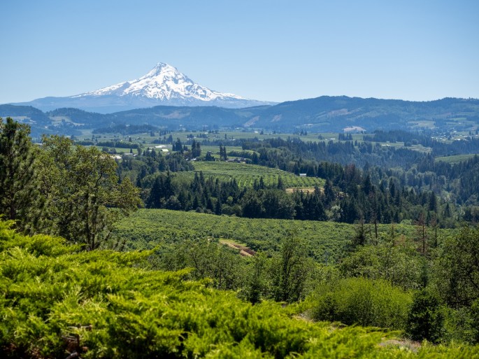
On the highway back to the campground, I noticed a sign pointing to “Panorama Point” and figured that had to be something good. I took the turn-off and drove a few miles uphill to be treated to a wonderful view of Mt. Hood (the mountain). I figured if I can’t be at the coast, I might as well enjoy the other beauties of this state. I also caught a glimpse of Mt. Adams to the north.
View of Mt. Hood from Panorama Point, my campsite is somewhere near the ridge in front of the mountain
I’ll have two days here to take it all in. And I just realized those two days are Saturday and Sunday. I guess I won’t be alone!