I assembled a photo slideshow of photos I took while on my road trip in the Pacific Northwest in May and June of this year. The video is about 5 minutes long and the musical soundtrack is the Cat Stevens song, “On the Road to Find Out.”
For the best enjoyment, click on the “Watch on YouTube” link below and choose to watch it in full frame mode.
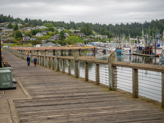
Thursday (June 17): My visit to this Washington peninsula would offer only two full days to explore the area. I knew the time would go quickly so I wanted to prioritize my choices. In addition to checking out this area, I also wanted to go back to Cannon Beach and spend a couple of hours there.
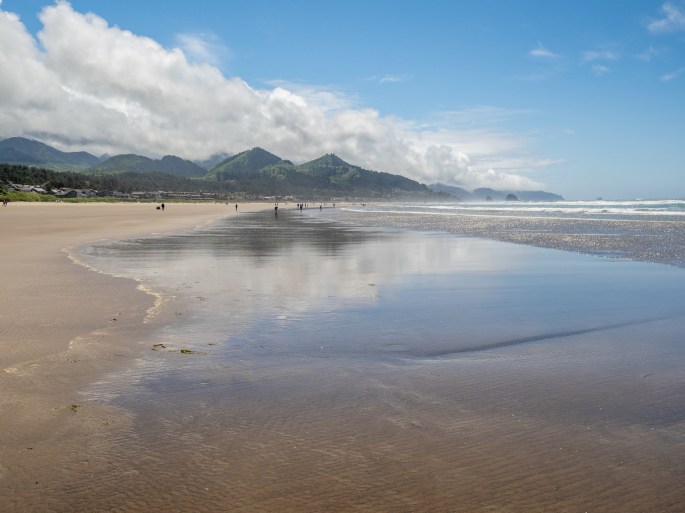
My visit to Cannon Beach was timed perfectly for the weather. After a rainy morning on Tuesday, the weather cleared by mid-day. Cannon Beach is a popular destination, with a vibrant downtown corridor and adjoining beach. Haystack Rock stands prominently as the centerpiece of the long flat beach. Parking in the area is competitive; I was fortunate to grab a roadside space near an entrance to the beach.
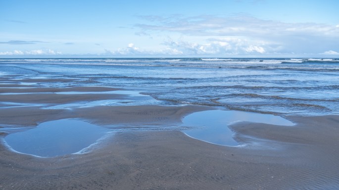
Haystack Rock on Cannon BeachLooking southLow tide Puffins! This is a composite of four images of puffins in flight.Beach reflections
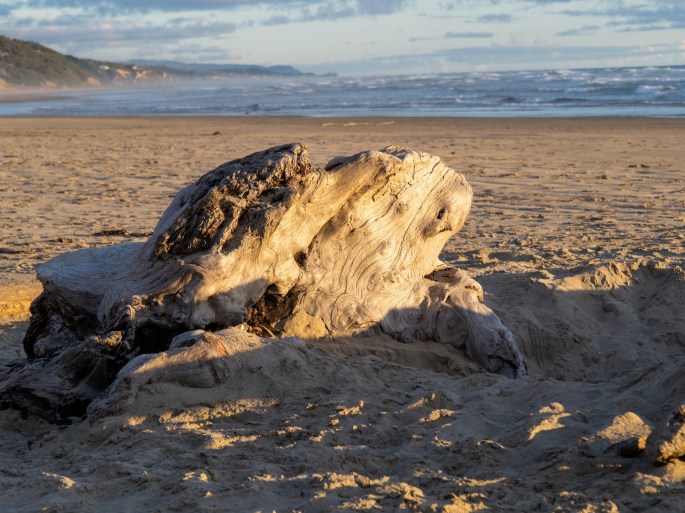
On the way back from Cannon Beach, I turned off to visit Fort Stevens State Park on the Oregon side of the Columbia River. Many of the river viewpoints were closed due to jetty construction. I was able to check out the shipwreck on the beach.
Shipwreck at Fort Stevens
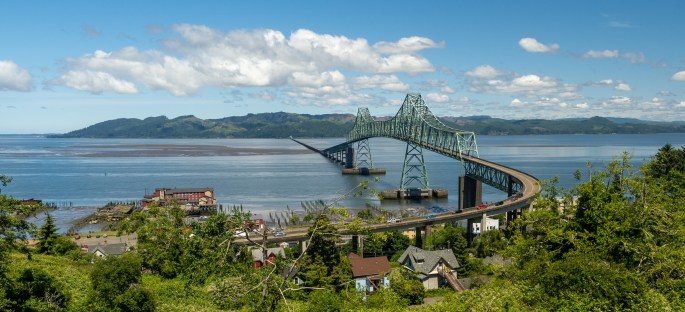
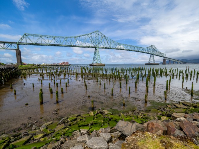
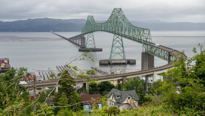
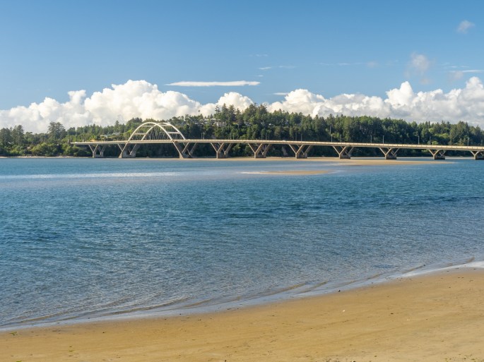
With the beautiful blue sky, I stopped in Astoria to get some new photos of the Astoria bridge. I returned to the same vantage point I took photos from the previous day. It’s a narrow residential street in the hills above the river with an excellent view of the entire bridge. I had to squeeze my car into a small turnoff space and walk a few blocks back to the best shooting spot. I was careful to not disrupt the homeowners on this street, I’m sure they see plenty of tourists checking out the view. I also drove down to the waterfront and walked along the area on either side of the bridge.
Wide view of Astoria BridgeView from the waterfront
On my last afternoon, I went to the Astoria Brewing Company located on the waterfront overlooking the river. Naturally I ordered fish and chips and a cup of chowder. The chowder was excellent but I’m not considering it as a candidate for my “best chowder” search. They add bacon to their chowder, which tastes great, but I call that cheating. I enjoyed eating the chowder, even though I had disqualified it. The halibut fish and chips were very good and I paired it with a very smooth blonde ale. I left the restaurant very satisfied with my last supper of the area.
Last supper at Astoria Brewing Co
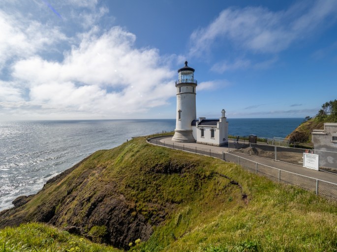
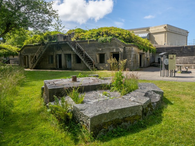
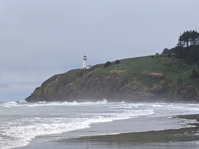
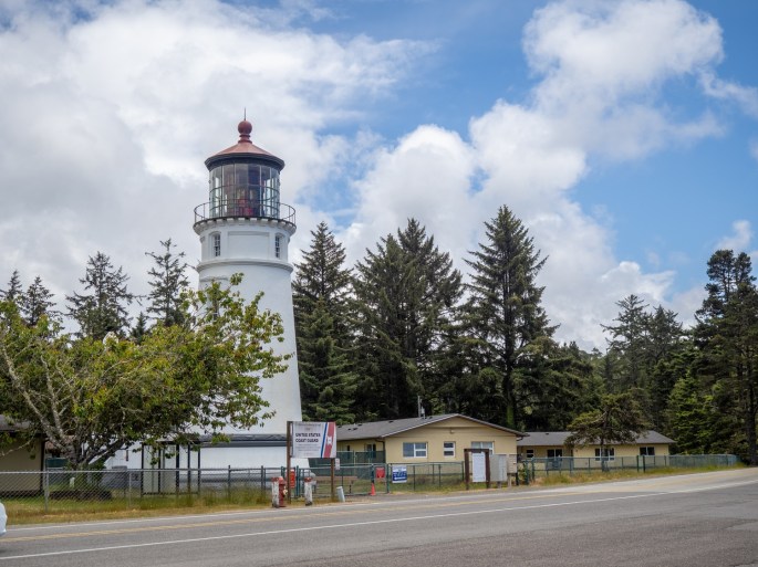
Cape Disappointment State Park includes more than the campground. This area reflects the history of the Lewis and Clark Expedition; the expedition reached the Pacific Ocean here at the mouth of the Columbia River. The park includes a Lewis and Clark interpretive center, two lighthouses and several historical remnants from the Pacific coast defense during World War II.
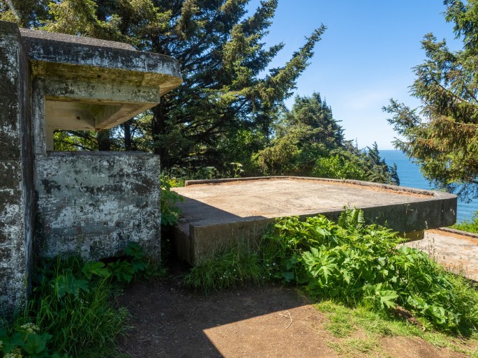
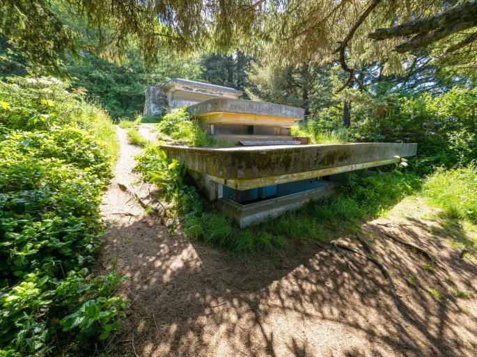
One of the lighthouses overlooks the beach next to my campsite; it is called the North Head Lighthouse. The park offers easy access to this lighthouse; a good sized parking lot and paved trail makes for an easy visit. This spot also has a trail to another viewpoint (called Bells Lookout) which gives hikers a chance to visit an old WWII bunker.
North Head Lighthouse above the campground beachNorth Head LighthouseWWII BunkerThree levels Ocean viewNorth Head LighthouseThis is the campground beach, looking back from the North Head Lighthouse
The other lighthouse is called Cape Disappointment Lighthouse and can be viewed from the Lewis and Clark interpretive center. This interpretive center is also home to the rugged structures of Fort Canby. While at the center I noticed a jetty that looked like it would have a great view of the lighthouse at water level. I consulted a map to see if I might be able to reach this spot and learned it is located in my campground. Very convenient and an excellent viewpoint of the lighthouse!
Cape Disappointment Lighthouse, viewed from the Lewis and Clark Interpretive CenterFort Canby at the Lewis and Clark Interpretive CenterFort Canby ExteriorFort Canby ExteriorFort Canby ExteriorCape Disappointment Lighthouse, viewed from the campground jetty
On the second evening of taking sunset photos of the Cape Disappointment Lighthouse, it drizzled for a few minutes. About 15 minutes later, a beautiful rainbow arced across the sky, directly over the lighthouse point. I was gifted with about 10 minutes of viewing (and photographing) this spontaneous gift.
Cape Disappointment Lighthouse at sunsetRainbow!Nightfall at the Cape Disappointment Lighthouse
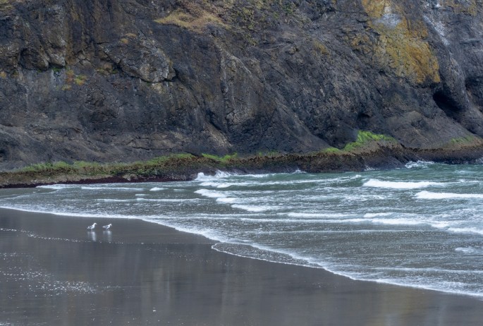
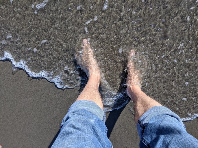
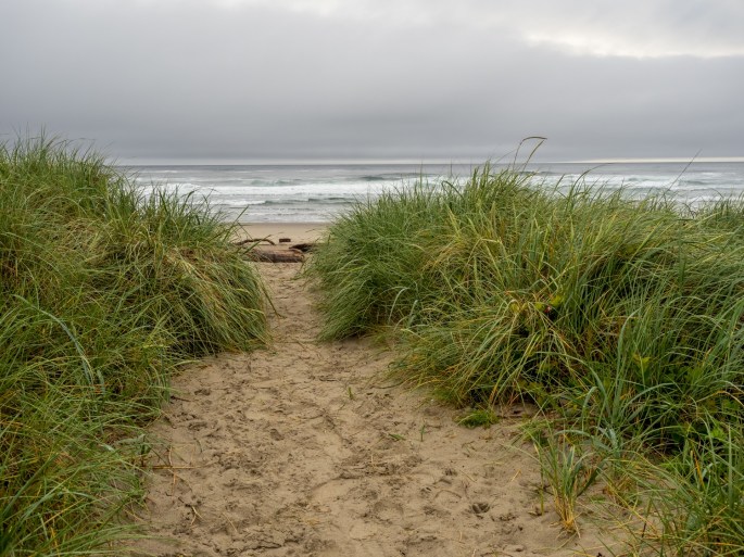
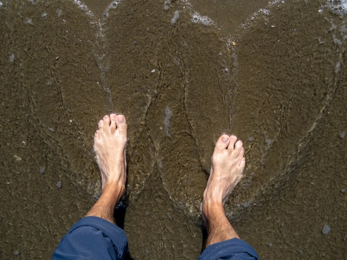
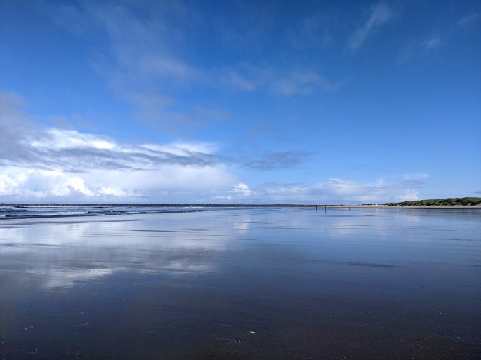
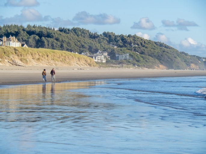
Before settling down for the last night, I visited the campground beach for one last walk. The wind was blowing fiercely but the walk in the water’s edge was pleasant and bittersweet.
Last walk on a beach
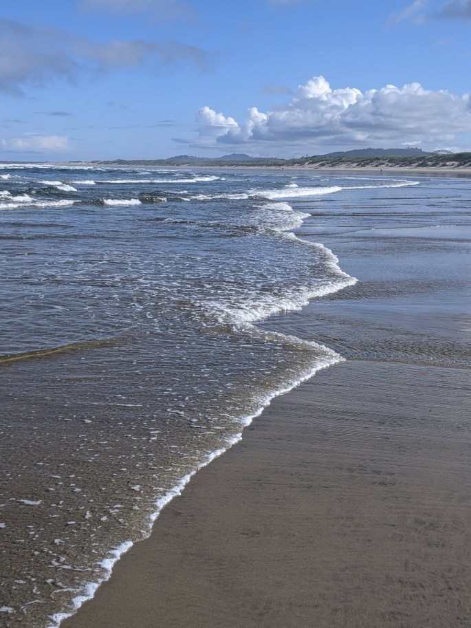
My time spent on the beaches over the last three weeks has been very rewarding. I’ve felt a special sense of peace while walking in the water, outrunning the seagulls in search of intact sand dollars, inspecting the little shells in the sand and watching the rhythmic rolling of the waves. This experience has been cleansing, calming and rejuvenating. I will miss the beaches I’ve visited.
Last walk on a beach
This is a turning point of my road trip. My next two travel days will take me inland toward Hood River on the Columbia River Gorge. In a way, I’ll have two trips: the coastline tour and the central Oregon route. As I say “Good Bye” to the ocean, I look forward to the new adventures that await me.
Monday (June 14): After 36 hours of soaking rain, Monday morning was dry(er); this made packing and closing up the trailer much easier. While breaking camp, I chatted with the gentleman in the next space. He was curious about the a-frame trailer and shared plenty of stories of his truck-driving days. We said our good-byes and I pulled away for another mini-trek to my next destination: Cape Disappointment State Park in Washington.
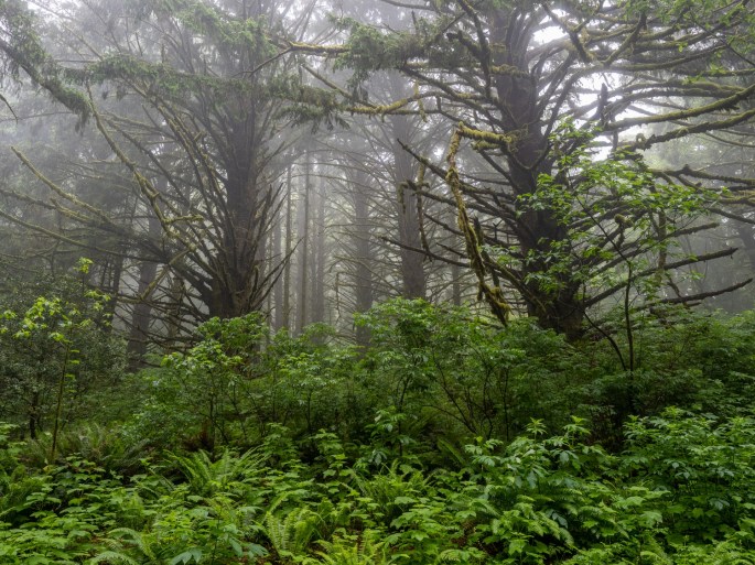
Traffic along the coastline was heavier than I expected, and the traffic progress was complicated by heavy fog in several places. I had hoped to stop at Cannon Beach for a lunch break, but decided in advance to continue onward if the fog had claimed Cannon Beach for the day. As it turned out, Cannon Beach was fogged in and I kept driving north. I did pull over for one foggy opportunity – I noticed some dense wooded areas off the highway with some excellent-looking fog in the treetops. I found a reasonable turnout and spent about 20 minutes walking up a dirt road through the foggy trees. It was a nice break.
A walk in the fog
Some of the other cities looked pretty interesting and I considered making a day trip to this area from the campground in Washington. I was mostly curious about Astoria, the last Oregon city I would drive through before crossing the Columbia River to Washington.
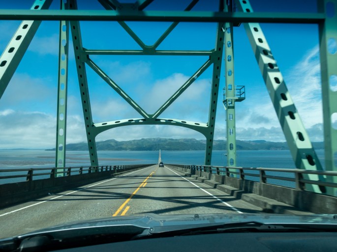
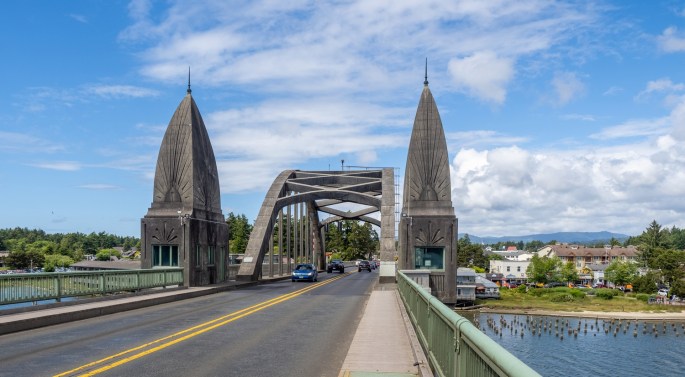
Before I had a chance to take a look at Astoria, an ominous sight appeared ahead of me. It was what I would call, “The Mother of All Bridges.” I had heard the bridge over the Columbia River was pretty high and long, but I did not expect it to taunt drivers from several miles away.
The Mother of All Bridges – The Astoria Megler Bridge.White-knuckling across the bridge
The route onto the bridge was very direct with no last-minute escape routes. I was committed to driving over it so I took a deep breath (maybe more than one) and pushed forward. Let’s just say it was breath-taking. I thought I was doing pretty well until I noticed my hands getting very tired from squeezing the steering wheel. I remembered the good golf advice about relaxing my grip, but this was no simple case of putting a golf ball. I was driving my car and trailer over a skinny, metal, two-lane, 4-mile long bridge that was tall enough for the largest ships to pass under. And it was windy. And I had to pee.
Once I crested the highest point of the bridge, the downhill slope was very stimulating. I could see contiguous highway ahead all the way to the Washington shoreline, but it was questionable how cars managed to stay on that thread-like strip of asphalt.
On the downhill side
Naturally, it was no big deal. Thousands of cars traverse that span every day and none of them spontaneously jump over the edge. I just wanted to be sure mine wouldn’t be the first one.
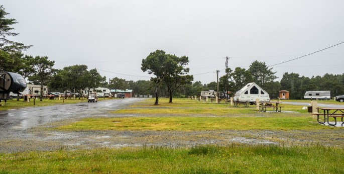
Cape Disappointment State Park is about 12 miles from the bridge and the Washington shoreline is beautiful. I entered the campground and set up camp, all the while noticing the clear and close sound of the ocean. I learned I was camping about 50 yards from the path that leads to the beach. So I checked it out.
Cape Disappointment State Park
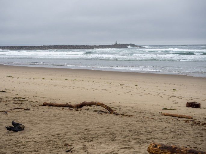
It’s another long beach, in fact, a nearby community is called Long Beach. I opted to take a short walk, and was pleasantly surprised to notice a lighthouse clearly visible and the north end of the beach. I did not know how this place became known as Cape Disappointment, but I was not disappointed.
This beach is very close to my campsite.
I returned to my trailer and set it up for my three night stay. This part of the campground is dry-camping with no electrical connection. I will be watching my battery power level and looking for chances to replenish it with the solar system. I’ll just need some sunlight, that’s all. Shouldn’t be a problem.
One note – the cellular signal in this park is very weak, so my updates during this time may be limited and delayed until I reach a better location.
Sunday (June 13): I’ve passed the mid-point of this trip; I planned 35 nights away and I’ve completed 19 nights. The time is going by much too quickly.
The weather forecasts were correct: the rain continued overnight and well into today. During the night, the rain was very heavy at times. Whenever I woke up I would check around the trailer to see if any water was leaking in. Not a drop! I am one happy camper!
I left the campground late morning and headed toward the Tillamook Air Museum about 20 miles away. With the 100% prediction of rain for most of the day, an indoor activity seemed like a good idea. However, I didn’t get there as planned.
This road led me on a search for fog in the hills.
While driving along Highway 101, I noticed some interesting fog patches clinging to the hilltops in the distance. I turned into the rural area and headed toward the hilltops, stopping occasionally to take photos. Eventually I found myself on a narrow country road winding between farm properties and open valleys. It was beautiful. There were very few places to pull over to take photos, so I would often stop in the middle of the road, get out, snap a few photos and get going again. With such little road traffic, this was pretty effective.
The road narrowed for several miles and followed a river.This area was fogged in with a moody atmosphere.
At the end of the road, I entered a small county campground, the Kilchis River County campground. The ranger at the entrance kindly encouraged me to drive around and check out the campground. It is nestled in the woods and the sounds of the Kilchis River drifted up from below. It seems so remote, yet is only about 6 miles from HWY101.
Kilchis River County Park campgroundBeautiful campsite at Kilchis River County Park campgroundKilchis River Abandoned train cars along the highway
Satisfied with the results of my foggy scavenger hunt, I got back on course and drove out to the Tillamook Air Museum.
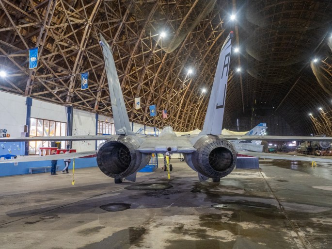
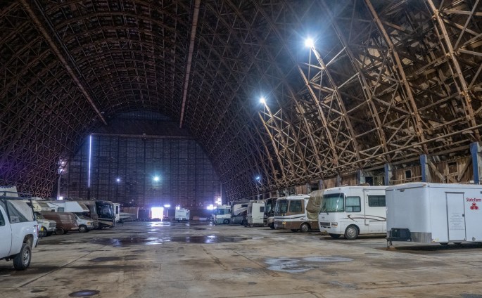
The museum is housed in an enormous wooden hangar, designed to store blimps. Its size makes it easily visible from the highway a couple of miles away.
Tillamook Air Museum is housed in a large wooden blimp hangar
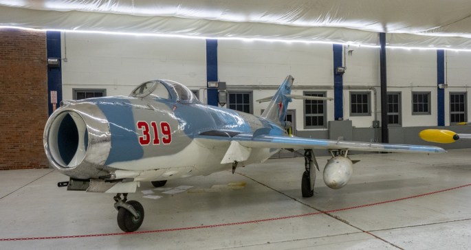
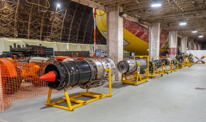
Upon entry, I was a bit underwhelmed. I expected to see numerous displays of full aircraft, something I’ve experienced in other smaller air museums. Instead, the, hangar interior featured three full aircraft, a few jeeps, some trainer cockpit displays and an smallish tarp-enclosed display room with small aircraft and vehicles. The far end of the hangar was closed off to the public and appeared to contain about 20 recreational vehicles. Heck, I would have enjoyed looking at those!
This building is huge.Miniature displays of WWII eventsF-14 The business end of the F-14Smaller aircraft and vehiclesEngine roomThe back section of the hangar appears to be an RV storage area.Looking from the rear of the hangar
I made the most of it and eventually left to head back to town to get some food supplies.
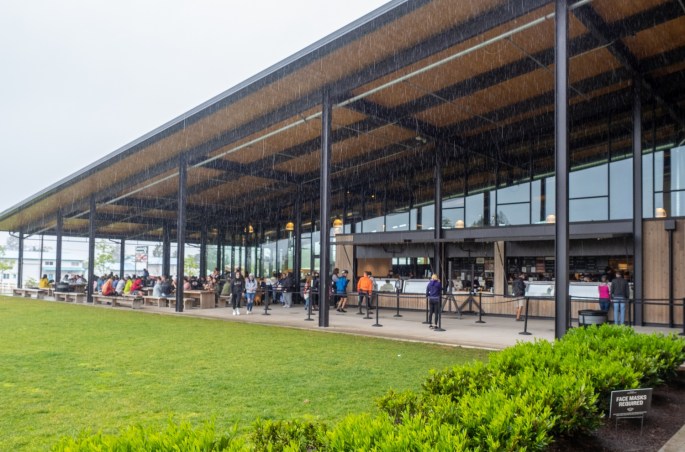
I stopped at the Tillamook Creamery and took a couple of photos of the crowds of people at the facility. The creamery is offering self-guided tours, with moderated numbers of people allowed in. A long line of umbrellas protected the owners from the steady rain while waiting to move indoors. The outdoor concession area was equally packed.
Waiting to enter the Tillamook CreameryOutdoor concessions at the Tillamook CreameryThe campground emptied out while I was gone
After returning to the campsite, I noticed the rain was lessening, so I ventured down to the beach for a last visit. The rain politely waited for me while I meandered along the water’s edge until I was satisfied. By the time I returned to my trailer, the rain reappeared and baptized me one more time.
Barview JettyBarview Jetty BeachFog action behind the beachBarview Jetty BeachOne last look at Barview Jetty Beach
Tomorrow I’ll head north and cross the Columbia River into Washington for my last beach campground visit.
Saturday (June 12): My time in Newport came to an end and I left around noon for another couple of hours on Highway 101 traveling north. I didn’t get too far before I came to my first side trip.
About ten miles north of Newport is the turnoff for the Yaquina Point lighthouse. It’s a short drive to a large parking lot (thankfully!) near a visitors center. The lighthouse is a quarter-mile walk from the parking lot. It was a sunny afternoon and the walkways and lighthouse viewing area were well attended by others enjoying the pleasant Saturday.
Yaquina Head lighthouseOne of the viewpoints near the lighthouseYaquina Head lighthouse
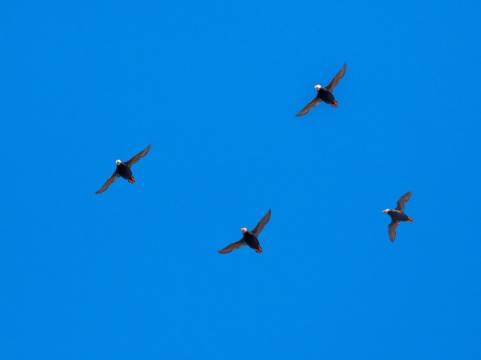
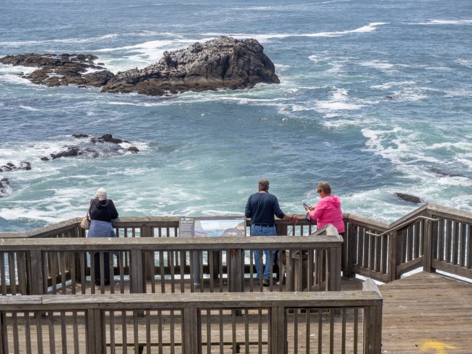
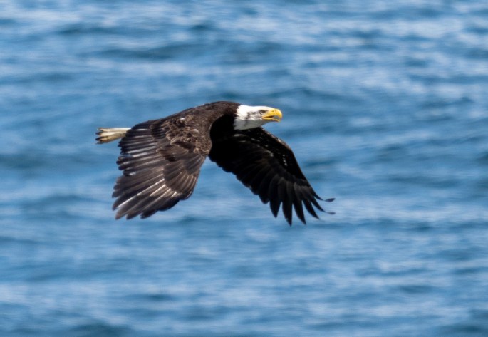
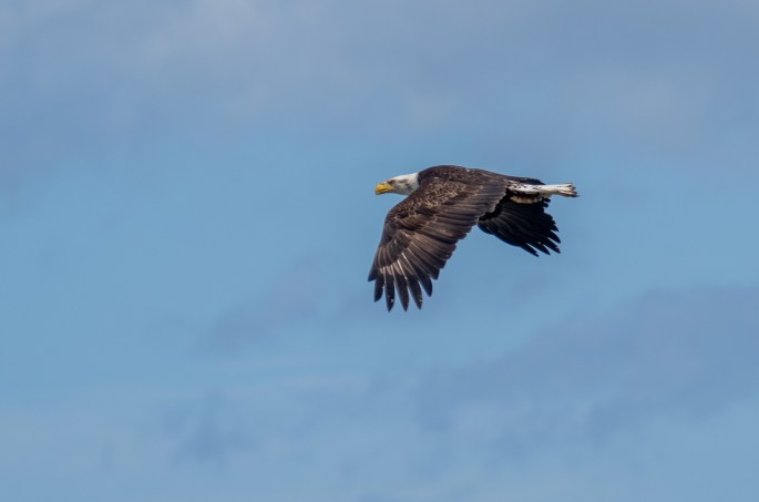
After taking my standard battery of lighthouse photos, I spent some time looking at the wildlife in the area, specifically a large rock located a couple hundred feet from a viewing area. The upper part of this rock was covered with various birds. I took a few photos of the vast numbers of birds when I noticed some commotion near the rock. A bald eagle had begun scouting the area and several seagulls began harassing the eagle to encourage it to move along. The bald eagle ignored the seagulls, made a couple of passes over the rock, then approached more closely but it didn’t seem to score a meal. In a matter of two minutes, the eagle flew away.
Cruising for lunchGetting too close for comfortSeagull harasses the bald eagle, they look like they are exchanging insults.Leaving with no morsels
I was furiously changing settings on my camera in an attempt to get a decent photo of this bald eagle in flight. I was able to get one clear shot of it, out of a few dozen attempts. With my camera fully ready, I waited a while to see if the eagle would make another attempt; eventually I walked back to my car and continued on the road.
Victory lap!
I remembered the weather forecasts for my destination indicated rain would be coming in during the late afternoon, so I didn’t want to delay my arrival too much. My usual preference is to set up before rain begins, and then enjoy it from the dry interior of my trailer.
The drive through the Tillamook countryside was beautiful, with lush green hills and open spaces. Since this is the home of Tillamook cheese, I assume the open spaces represent cattle grazing areas.
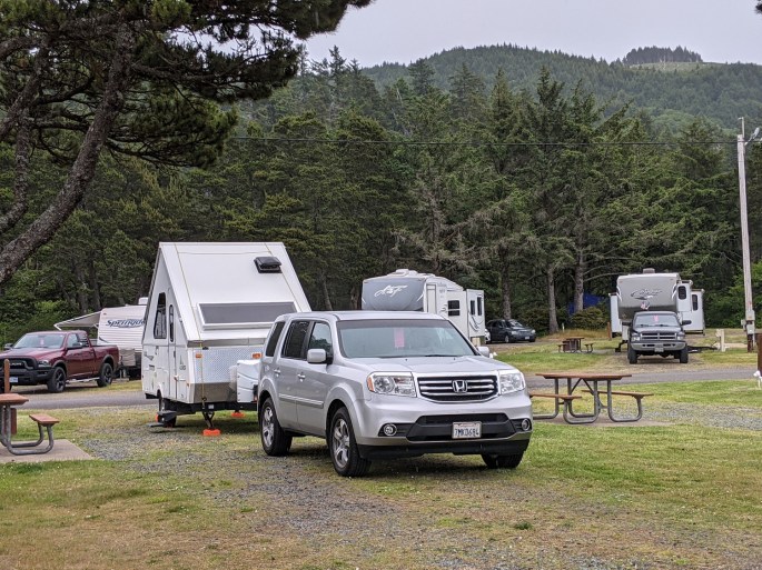
I reached the campground at 4:00 pm and set up my trailer. I’m staying about ten miles north of the city of Tillamook at the Barview Jetty County Park campground, which is very close to the beach. The campground is popular with families; a new large playground is the centerpiece of Kid Heaven here. The RV pull-through spaces have full hookups for a modest price of $38 per night.
Campsite at the Barview Jetty County Park campground
Even with the imminent threat of rain, I didn’t resist the urge to check out the beach. A short walk of 200 yards led me to the small dunes and beach. The sky was gray with a heavy fog/mist along the shore. More kids were playing on the sandy natural playground. I only had time for a SWOTB (short walk…) before the raindrops made their appearance. I upped my pace and returned to my trailer for dinner. By 6:00 pm the rain became much steadier and heavier. The forecast says the rain will continue until Monday morning, about the time I’ll leave.
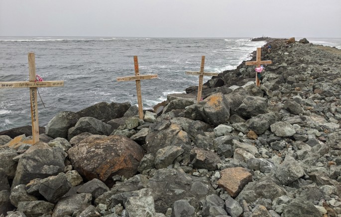
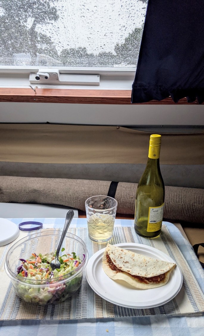
Rain is on its way, the fog/mist is heavy on the beachBarview BeachMemorials on the Barview JettyDinner on a rainy evening
Tomorrow I plan to visit the nearby Tillamook Air Museum, located in an enormous wooden hangar designed to house a blimp. It promises to be a great indoor museum and I hope it also promises to be dry!
Friday (June 11) The rain woke me up around 4:00 AM, so I knew Friday would be a good day for indoor activities. I noticed my satisfaction with having taken care of the trailer repacking the previous dry afternoon.
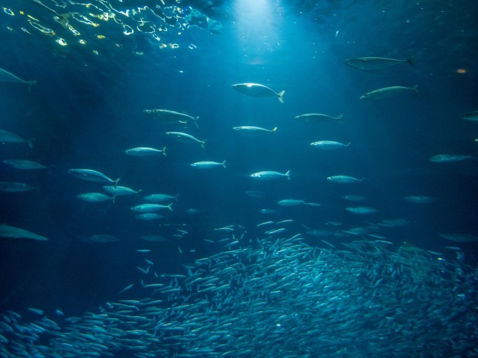
I had purchased a timed entry ticket for the Oregon Coast Aquarium, so I got up and got ready for my 9:30 AM appointment. The aquarium is modest yet very well designed. Some of the more tactile exhibits were still closed due to Covid. With the limited time entries, the facility was not crowded. I spent about two hours walking through the exhibits and taking photos. The walk-through underwater tubes are my favorite, with various fish swimming around, over and under the walkways.
Part of the new fossil exhibitPuffins!Black Sea NettlesJellyfish exhibit
In the afternoon the weather had dried out a bit, but the wind was still strong and cold. I met up with my friends at Roque Ales and Spirits for some pre-dinner beer tasting. I tried a flight of four beers and each one was uniquely tasty.
Pre-dinner beer tasting at Rogue
After some spirited conversation, we drove across the bridge and met at Local Ocean, a highly-recommended seafood restaurant on Newport’s bayfront area. This is one of their favorite restaurants and we were seated at the upper level corner window looking out over the bay. I ordered the wild king salmon dinner and it was superb! The salmon was cooked to perfection and the combination of vegetables and linguine was a delight.
Local Ocean Seafood Restaurant
Afterwards, I rode shotgun in their Class B RV and we took a driving tour to nearby Nye Beach and Agate Beach. We walked out on Agate Beach but the chilly wind was too strong to stay long. We drove back to the bayfront to my car and said our good-byes. It was fun to spend the time with them and experience a terrific restaurant. This was a great way to spend my last evening in Newport.
Thursday (June 10): The first order of business was a morning LWOTB.
Morning beach walkThe tide was lower this morningReflections on the wet beachCold water!
After a light breakfast, I made the short drive to Yachats, a small hamlet about 25 miles south of Newport. I had driven through Yachats on the way to Newport and made a note to check it out.
Yachats is a cute village with a vibrant food/drink/craft section. I noticed a tiny little shop called “Just Local.” The shop featured hand made craft items by local artists and crafters. I immediately discovered two items that I admired and made the purchase.
Shops in YachatsYachats
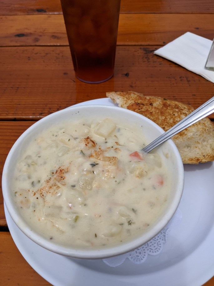
I walked down by the shoreline and took a few photos, then headed back up to the main street (HWY101) to look for lunch. I chose Luna Sea Fish House and ordered a bowl of clam chowder with garlic bread. The clam chowder was excellent, so delicious that I am declaring it better than the Hungry Clam chowder I had been comparing everything else to. So: Winner, Winner, Clam Dinner!
Yachats shorelineHome of the “Best Chowder”Best Chowder (as of June 9)!
After a quick stop at a chocolate shop for a few(!) items, I drove back toward Newport. I continued in to town and checked out the Yaquina Bay area. The Yaquina Bay bridge is the centerpiece of the bay and is also the primary north/south route through the area. This bridge is another engineering marvel by Conde McCullough. The bayfront area is packed with restaurants, coffee shops, novelty stores, fish markets, and believe it or not – a Ripley’s Believe It or Not!
Yaquina Bay BridgeNewport’s BayfrontFree street performersYaquina Bay harbor
I returned to the campsite and began re-arranging the mess of items in my trailer and car. With a forecast of rain on its way, I decided it was time to get it organized and put everything back in the trailer. I felt the trailer had dried out enough, and I did not want try to take care of this while it was raining.
By late evening, the wind began to blow harder and the clouds got darker. It would occasionally drizzle, but I knew a bigger storm was on its way. I hunkered down for the night and promptly dropped off to sleep.
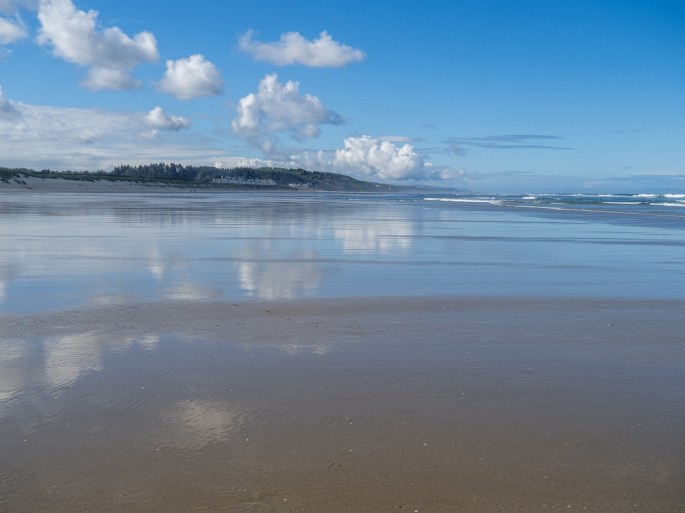
Wednesday (June 9): I slept solid after all the excitement on Tuesday. The bright sun and blue sky tempted me, so I dressed quickly and walked 1/4 mile to South Beach. The crisp air was refreshing and I walked barefoot in the shallow surf. The water was stunningly cold but after awhile my feet were so numb I didn’t notice. A few others were also out on the beach on that morning. As I walked along, I began searching for sand dollars that washed up on the shore. Most of the ones I saw were partial pieces and any round ones had been chipped open by the seagulls.
A long walk on a beach requires a long beach.Looking for a wave
After about 45 minutes of intense searching, I had found 4 undamaged sand dollars. I was rich! I looked up and noticed how far I had walked. Actually, I had no idea how far I walked because I couldn’t see where I started. I wandered back and eventually located my starting point and walked back to my campsite. I made coffee and breakfast and started planning my day.
My beach bounty
A former coworker had contacted me a couple days earlier; he and his fiance were staying at a nearby Thousand Trails campground during the same time I would be in Newport. I reached out to him and arranged to stop by their campground for a visit. I met his fiance and another friend, took a walking tour of the campground and checked out the beach nearest to them. I wondered if I had kept walking that morning if I would have ended up at their beach. I estimated it to be about four miles away.
We agreed to meet for dinner on Friday afternoon and I left to run some errands. I needed to get a few supplies to finish my trailer cleanout from the previous day. When I returned to my campsite in the afternoon, I took an unplanned two-hour nap. I guess I was tired.
After an early dinner, I headed back to the beach for a sunset LWOTB. I found a few other shells and took photos of the sunset and beach objects I came across.
Sunset walk on the beachSunset walk on the beach
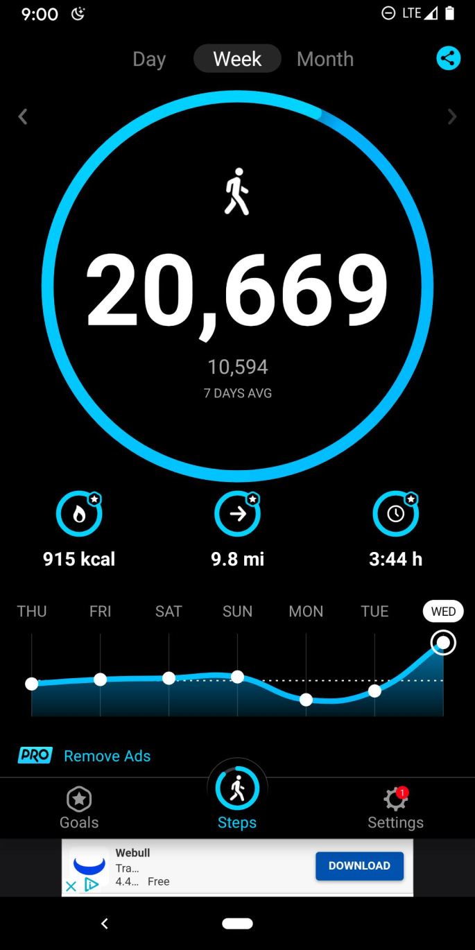
My Steps app let me know I had accomplished my steps goal for the day!
Monday (June 7): It was time to pack up and advance to my next destination: South Beach SP near Newport. I left Sunset Bay campground a little after noon; the drive was estimated at two hours, but with some planned stops I guessed it would be late afternoon before I finished the day,
My first side trip was to check out the Umpqua Lighthouse, just a few miles off Highway 101 near Reedsport. The lighthouse was located among some older buildings and was surrounded by a fence. Signs in the area indicated that no tours were available. A nearby museum and gift shop were both open and a few visitors roamed the grounds.
Umpqua LighthouseMuseum at Umpqua Lighthouse
I didn’t spend much time in the area and noticed I was getting hungry for some lunch. I planned to stop in Florence for a meal so I continued north. I rolled in to Florence around 1:30 in the afternoon, found a large parking space near the waterfront and began exploring. The waterfront has several streets of stores, restaurants, art galleries and coffee shops. A few restaurants with water views were also open. Before eating I walked around the spectacular bridge that spans the Siuslaw River. It is one of the several bridges designed by Conde McCullough, a bridge engineer for the Oregon State Highway Department in the 1930’s.
The bridge over the Siuslaw River at Florence OregonWalking under the bridge on the Siuslaw River at Florence OregonWalking on the bridge over the Siuslaw River at Florence OregonFlorence Oregon’s waterfront on the Siuslaw River
I took the above photo of the waterfront from the middle span of the bridge. I don’t tolerate high locations with wide open spaces, so walking along the bridge’s narrow walkway next to speeding cars was a test of nerves. Thankfully, nobody got the impulse to lay on their horn while passing me.
That was enough excitement for one day, so I sat down at an outdoor table at the International C-Food restaurant overlooking the harbor. It was a pleasant day and the large restaurant building blocked most of the strong breeze. I ordered fish and chips and chowder for lunch (my third tasting of this combination for this trip.) I think this restaurant’s chowder was just as good as the Brookings Hungry Clam’s chowder. I still give a nod to the Hungry Clam for their more generous serving, though.
My view during lunch of the harbor in Florence
After finishing lunch I planned my next diversion. I knew the Haceda Head lighthouse was just a few miles north of Florence and I had read that some great views of the lighthouse were available at turnouts along the edge of the highway. I scoped out the area on Google satellite maps and strategized my attack: I would drive past the turnouts to identify the best ones and then turn around at the lighthouse parking lot and return on HWY 101 to the turnouts. As I drove near the area, I could see the incredible views of the coastline and lighthouse and picked out the best turnout.
I continued up to the parking lot to excitedly begin my return trip. However, I managed to end up in the part of the parking lot that had a sign posted (much too late to be useful) that there was no trailer turnaround. The parking lot was one driveway with right-angle parking spaces on each side and a dead end at the far end. Several cars and people were actively moving about and I knew this was going to be very interesting. Trying to remain calm, I scoped out a couple of open parking spaces on my left and an open one on the right and decided I was going to turn my trailer around in spite of that damn sign’s opinion. Immediately I noticed several cars waiting behind me, so the pressure was on.
After a couple of the back and forth maneuvers I got the hang of it and got the heck out of there in a hurry. That was enough excitement for one day, so I took a deep breath and aimed my car for the highway turnout. It was open when I arrived and the view was better than I could have imagined. The sky was clear blue with puffy white clouds, the water below was blue with terrific waves crashing on the beach, and the lighthouse stood out sharply against the rocky terrain. After the mundane view of the Umpqua Lighthouse, the Haceda Head Lighthouse overachieved. Not satisfied to show you just one photo, I’ve included four images from wide to up close.
The Haceda Head Lighthouse from afarThe Haceda Head LighthouseThe Haceda Head LighthouseThe Haceda Head Lighthouse up close
I was satisfied with all the effort it took to get to this point and capture these images. Now I had just one more u-turn to make to get back on the path to Newport. Rather than drive farther south to find a suitable place to turn around, I quickly flipped the u-turn right out of the turnout when traffic was clear and drove north again. I should have layed some rubber just for effect. I continued on leisurely and enjoyed the remainder of the drive.
Another interesting bridge along the shorelineThe Alsea Bay bridge at Waldport.
I reached South Beach State Park and parked in my campsite around 7:00pm. After the lengthy time in the car, I was ready to set up and wind down. However, when I opened up my trailer I was greeted at the door by a jar of salsa. Looking up I noticed the refrigerator door slightly ajar and several other food items strewn across the floor. Annoyed but not dismayed, I started to gather the items and then I noticed something awful. A large plastic jug was laying on it side on the floor near the rear of the trailer. This was the jug that had a block of ice in it to help keep the fridge cold during the drive. But the block of ice was very small and the puddle of water (previously know as ice) on the floor was very large. I knew water damage was serious and began quickly emptying out my trailer. I located the places where the water had reached inside some of the compartments and dried it up as much as possible. I opened all the affected hatches and emptied them to make room for ventilation. This was not how I wanted to set up for the evening!
All compartments were emptied and dried out.
I stashed most of the trailer items in the car and repaired the refrigerator door. I noticed a small threaded hinge pin had worked itself loose, allowing the door to sag and render the latch useless. I tightened that screw down super-tight, got the door back together and called it a night.