
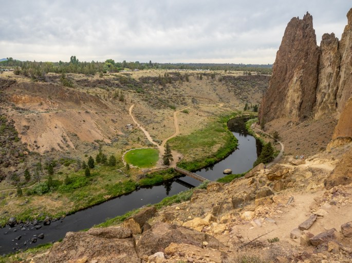
Tuesday (June 22): The Smith Rock State Park is located about 20 miles from Prineville. The park reopened less than a month ago after being closed for more than a year due to Covid.
I spent a couple hours at Smith Rock hiking the trails this morning. After last night’s thunderstorm and balmy night, it felt good to walk in the cooler air. Not only was the air cool, it was absolutely still. Occasionally, I would stop hiking to take a photo and notice the silence. It was so quiet that I felt conspicuous when I restarted hiking because my shoes were making noise.
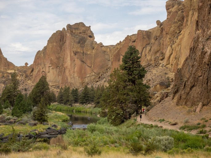
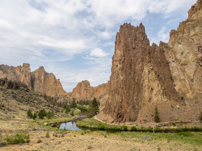
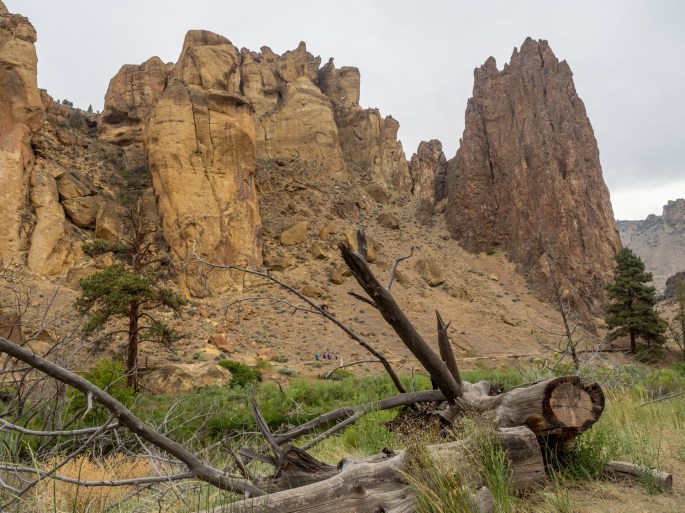
This area has stunning rock spires that stretch vertically from the canyon floor. The Crooked River wiggles through the spaces between the rock faces. In the 80’s this park was a huge draw for rock climbers. Now, in addition to the continued focus on rock climbing, miles of trails beckon hikers and bikers to explore the area. I hiked trails in both directions along the river’s path.


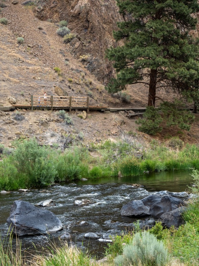
After returning to my starting point, I got the notion to take the Misery Ridge Trail. Somebody had a sense of humor when they named this trail. It immediately transitions into switchbacks as the hiker climbs from the trailhead at the bridge.


I climbed about half the vertical height of this trail before stopping. I was rather proud of myself for not being intimidated by the sheer height of the trail, as well as its close proximity to the steep edge. When I began to hike back down, all that changed. When hiking down it was hard to not see the height and precariousness of the trail.

By the time I reached the bottom I was pretty tired. I still needed to cross the bridge and climb out of the canyon one more time. Slow and steady was my mantra (when I could breathe). The cool air had warmed up by late morning, and the humidity seemed to have increased, too.

I drove into nearby Redmond and met up with a former co-worker/current friend for lunch. Jerry and I share a strong interest in photography and we often send emails back and forth discussing the latest photo gear and techniques. He had recommended I visit Smith Rock SP and gave me good advice to get there early before it got too busy.
We had a terrific lunch of tacos from a food truck parked at a taphouse. It was fun to catch up with him and he had more suggestions of places to check out in the area.
I spent the remainder of the afternoon buying groceries and supplies for the last week (sniff, sniff) of my trip. When I was leaving Safeway in Redmond, the lightning and thunder had started. I drove back to Prineville and outran the storm by a couple hours. When the storm did arrive, it was not nearly as powerful as the previous night’s fracas. In addition to another stunning sunset, I was treated to a full rainbow at the RV park. One end of the rainbow burrowed into the roof of my trailer. I think I should name my trailer “Pot of Gold.”

Tomorrow is the first of another two-day travel leg. When I stop for the night tomorrow, I’ll be back in California.
– + –

Quite a bit different land up there. It looks a little like Nevada.
LikeLike
This area is high elevation desert, so yes, some similarities to Nevada. I’ve been reminded of the Eastern Sierra here as well.
LikeLike
Was there a waterfall at the far end of Smith Rock SP??
On Tue, Jun 22, 2021, 11:13 PM Roadtripping with Ron wrote:
> nabityphotos posted: ” Tuesday (June 22): The Smith Rock State Park is > located about 20 miles from Prineville. The park reopened less than a month > ago after being closed for more than a year due to Covid. The Crooked River > winds through the park I spent a couple hours a” >
LikeLike
I don’t know, I didn’t explore out that far. The trails map doesn’t show one.
LikeLike
Aren’t all rivers “crooked”? I don’t remember ever seeing a “straight” river.
Looks like Pinnacles National Park near Hollister, CA
LikeLike
Haha, good point about the river. Maybe this one is more crooked than most.
LikeLike